Thursday, April 1, 2010

New POC for Veolia with Tellus

A new prototype required by Veolia (France) is done with Tellus. The idea is to show the selection of different tube (for maintenance) on the map and o switch to OpenMIS engine to generate intervention report.
Here you can watch the POC : http://www.youtube.com/watch?v=7AT2cnI7l6I
Here you can download the code : svn://@svn.forge.objectweb.org/svnroot/openmobileis/trunk/modules/Tellus/Veolia

Wednesday, March 31, 2010

OSGeo live DVD released - Tellus included in it!

The latest version of the OSGeo Live GIS Disc was officially released yesterday. The aim of this project is to provide bootable ISO-Images and Virtual Machines which allow users to try out fully-operational versions of popular Free Geospatial Software without the need to install a thing. Everything is set up for you ready to go: just reboot into it, glance at the help pages on the desktop, and go.

OSGeo Live GIS Disc download site:
http://download.osgeo.org/livedvd/

The latest version is called Arramagong 3.0 and includes Unofficial gvSIG Mobile for Linux v. 0.1.6, whose main functionality is the feature synchronization, using the module from the Tellus repository.

The mascot of Arramagong 3.0 is this nice wombat (Australian marsupial).

Friday, February 12, 2010

Tellus will be in the OSGeo live DVD

The Open Source Geospatial Foundation, or OSGeo, is a not-for-profit organization whose mission is to support and promote the collaborative development of open geospatial technologies and data.

Among other things, OSGeo usually distributes live DVDs (Linux) or pen-drives with a selection of open-source GIS software to gain publicity. In the next version of that DVD, OSGeo will include Unofficial gvSIG Mobile for Linux devices.

I will include three little PDF files in the DVD, which will be easily accessible for those who start the DVD. The files are:


I have added a British gallery because in June there will be an important GIS event in Nottingham, and this DVD will probably be distributed there as well.

Monday, January 25, 2010

Juan's project for featured-oriented synchro is on OW2Forge

OW2Forge give news on Tellus project (Juan's project part ) on : http://forge.ow2.org/forum/forum.php?forum_id=1764 for the featured-oriented synchronization.

Saturday, January 23, 2010

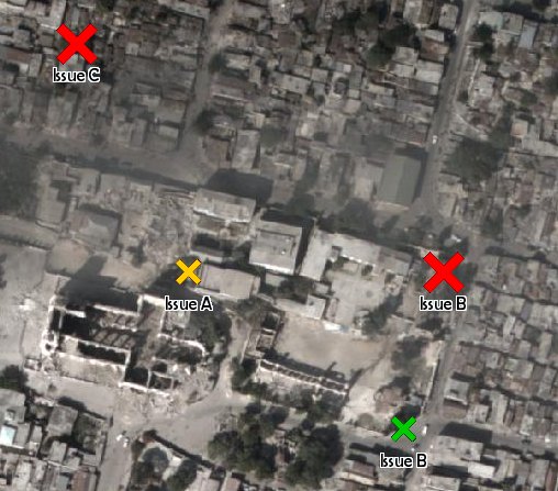
Haiti

The situation in Haiti is an example where synchronization of POIs is a good option:


  • As soon as a surveyor reaches an internet-enabled spot, new POIs are added to the database and WMS clients (for example in a coordination office) can see the changes instantly.

  • As new POIs from surveyors A, B, and C get into D's handheld, D knows which areas need more attention and needs not update large amounts of raster data, since each point feature needs only a few bytes to be transmitted.


This is what the surveyor does:


This is what the WMS client shows:


Server:
http://hypercube.telascience.org/cgi-bin/mapserv?map=/geo/haiti/mapfiles/4326.map

I think layer is correctly georeferenced:
noaa-01-18-4326

Tuesday, December 22, 2009

Source code links

Mode A

  • gvSIG Mobile and the Openmis application (both on the PDA) communicate via SOAP messages (web services)
  • The source code for this (Tellus framework - Beta V1 version) can be downloaded from [here]
  • See a video [here]

Mode B

  • The Openmis libraries (JAR files) are added as a dependency in gvSIG Mobile, and a new FODB driver is used inside gvSIG Mobile
  • The instructions to set up the Eclipse workspace for this are [here]
  • See a video [here]

Friday, December 4, 2009

Tellus presentation done!

The Tellus presentation in the 5th international gvSIG conference took place as scheduled on Thursday 3 December 2009 at 4 pm at the Convention Center (also known as Obus) in Feria Valencia (Spain).

Presentation slides:


Video A by Manu Gomez, file-oriented, using web API for mobile applications:


Video B by Juan Lucas Domínguez, feature-oriented, using a FODB driver inside gvSIG Mobile:


Article with technical details: